Find us
Magog Down is located on the Gog Magog Hills just south of Cambridge and is signposted off the A1307 and Haverhill Road. Nearest postcode to the entrance is CB22 5FX (i.e. for Gog Magog Cottages). [Google maps gives CB22 3AE but this is incorrect.] Grid reference – TL48628 53190. If using the What3words app (gives location details down to a 3m square), the car park entrance reference is – ///casual.infringe.warns.
Magog Down is 2 miles south of Addenbrooke’s Hospital roundabout on the A1307 between Cambridge and Haverhill. There is a cycle path from the Babraham Road Park and Ride site (where there are toilet facilities) alongside the A1307 before the turning into Haverhill Road and there is a multi-user path from Stapleford village to the entrance.
In addition to the main car park entrance, there are pedestrian gates at either end of the Public Footpath which runs diagonally across the North Down, i.e. one gate near Gog Magog Cottages on Haverhill Road, and the other gate is on the A1307, nearly opposite the entrance to Wandlebury Country Park, and close to the bus stop.
Stagecoach 13, 13A, 13B and X13 bus services between Cambridge and Haverhill have stops on either side of the A1307 from which you can walk to enter Magog Down at the gate opposite Wandlebury Country Park. You can plan your bus journey to/from Magog Down by using the Stagecoach East Guide to Tickets & Fares page.
View map of site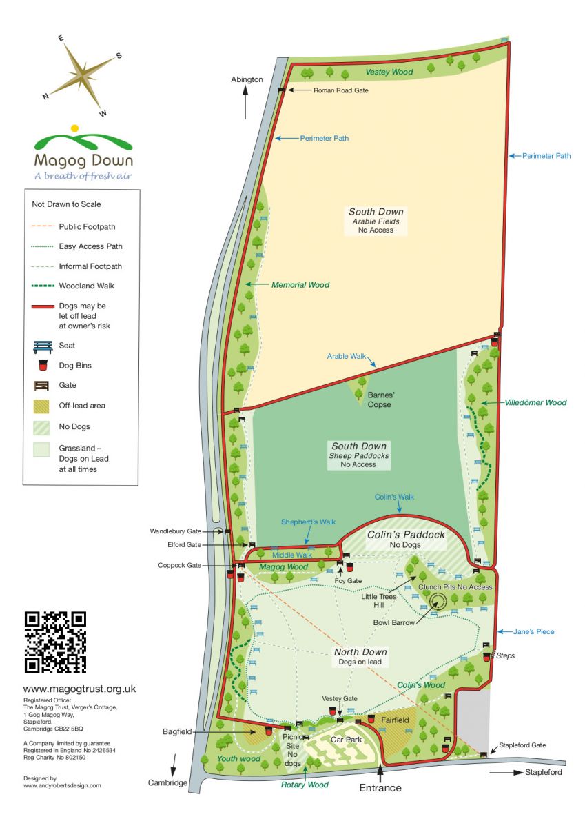
